Endorsed Draft Camden Head Master Plan
Consultation has concluded
Council is now accepting formal nominations for membership of the Friends of Camden Head Lookout group.
Nominations are open until Friday 29 November 2024. (Updated 1 November 2024)
Find out more and nominate
Important Update (18 November 2024). At the 14 November Ordinary Council Meeting, Councillors made the following resolution, that Council: 1. Note the information contained within the Camden Head Lookout Master Plan Community Engagement Report - July 2024 2. Note that preliminary works have commenced at the site to tidy up the site as per Council’s July 2024 resolution on this matter. 3. Adopt the Amended Camden Head Lookout Reserve Master Plan included in Attachment 5 to the report for Item 11.01 Camden Head Lookout Master Plan Engagement Outcomes - Post Exhibition Report of the July 2024 Ordinary Council meeting. 4. Endorse the establishment of a Friends of Camden Head Lookout volunteer group and proceed to establish the group.
The information contained below was relevant at the time of engagement in June 2024 and may have changed as this project has progressed.
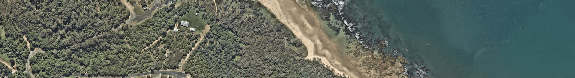
We are pleased to share with you Councils Endorsed Camden Head Draft Master Plan that outlines a staged approach for the future development of the Camden Head Lookout Reserve.
Council is also seeking expression of interest from the community to be involved in the management and maintenance of the Camden Head Lookout Reserve in accordance with a future Master Plan once adopted by council.
We are also sharing a Proposal put forward by a local stakeholder for comment.
At the Ordinary Council Meeting on 16 May 2024, Councillors endorsed the Draft Camden Head Master Plan for the purpose of public exhibition for a period of not less than 28 days.
Councillors also included for exhibition the Individual Stakeholder Proposal that was presented at the Public Forum on 13 May 2024 for a period of not less than 28 days.
The Endorsed Draft Master Plan has been designed with sensitivity to all parties involved taking into consideration alignment with community needs, accessibility and inclusivity, environmental impact, social and cultural impact and economic viability.
 The Endorsed Draft Master Plan outlines four stages that include:
- Picnic Area Enhancement: Addition of two new picnic tables, creation of a new pathway connecting the road to the beach boardwalk, and installation of signage.
- Pathway Extension and Picnic Area: Addition of two more picnic tables, extension of the pathway, establishment of a grassed picnic area with some tree planting.
- Vegetation Enhancement: Infill planting between existing vegetation, with a focus on maintenance and management. Extension of the pathway to connect to an existing boardwalk leading to the beach.
- Carpark Formalisation: Formalisation of car parking areas at the front of the site and in the existing adjacent area (managed by NPWS).
 The Individual Stakeholder Proposal outlines four stages that include:
- Clearing and Mulching: Clearing areas near the fence and mulching to encourage the growth of endangered grasslands.
- Picnic Area Enhancement: Replacement of picnic tables, addition of picnic tables, garden beds, and BBQ facilities.
- Pathway Improvement: Creation of meandering pathways to reduce access slope, linking to stairs and boardwalks for easier access.
- Canopy Thinning: Thinning of the canopy to allow native grasses to propagate, with the creation of a pathway linking to a boardwalk for access to the bottom car park and amenities.
- Formal Carparks: Establishment of formal car parks for visitors.
- Interpretive Signage: Installation of interpretive signage to provide information about the area.
You can view the Endorsed Draft Master Plan and the Individual Stakeholder Proposal to the right (or below if viewing this page on a mobile device) under documents. A side-by-side comparison of both plans is also available for download.
Land Zoning
The Endorsed Draft Master Plan is designed on land zoned RE1 Public Recreation, which is on Crown Land that is managed by Council. You can view the zoning and tenure map in the documents to the right (or below if viewing this page on a mobile device).
Zone RE1: Public Recreation - Objectives of zone
- To enable land to be used for public open space or recreational purposes
- To provide a range of recreational settings and activities and compatible land uses
- To protect and enhance the natural environment for recreational purposes.
Zone C1: National Parks and Nature Reserves - Objectives of zone
- To enable the management and appropriate use of land that is reserved under the National Parks and Wildlife Act 1974 or that is acquired under Part 11 of that Act.
- To enable uses authorised under the National Parks and Wildlife Act 1974.
- To identify land that is to be reserved under the National Parks and Wildlife Act 1974 and to protect the environmental significance of that land.
Zone C2: Environmental Conservation - Objectives of zone
- To protect, manage and restore areas of high ecological, scientific, cultural or aesthetic values.
- To prevent development that could destroy, damage or otherwise have an adverse effect on those values.
- To protect coastal wetlands and littoral rainforests.
- To protect land affected by coastal processes and environmentally sensitive land.
- To prevent development that adversely affects, or would be adversely affected by, coastal processes.
- To enable development of public works and environmental facilities where such development would not have an overall detrimental impact on ecological, scientific, cultural or aesthetic values.
For more information about Land Zoning please visit Port Macquarie-Hastings Local Environmental Plan 2011.
The Camden Head Lookout Reserve is classified as High Environmental Value which recognises threatened species or communities with potential for serious and irreversible impacts. This constraints Council's involvement in vegetation management including factors like where the vegetation is, its type, land ownership, zoning regulations, planned land use, existing legislation, and the council's specific roles and responsibilities. These factors shape how the council assesses development, manages the environment, enforces regulations, educates the public, makes decisions, maintains land, and protects vegetation.
Tenure Map
A tenure map shows who owns or uses land in an area and for what purpose. A tenure map identifies land ownership, leasing, reservation, or allocation for uses within a specified area. You can view the Camden Head Tenure Map under the documents tab.
Zoning Map
A zoning map is a visual guide that displays different areas designated for specific uses. It's an official part of guidelines and tells you what activities are allowed in each zone. You can view the Camden Head Zoning Map under the documents tab.
Friends of Camden Head
At the Ordinary Council Meeting on 16 May 2024 Councillors resolved to seek expressions of interest through the engagement process for community members to express their interest in becoming a volunteer member of “Friends of Camden Head”. The Friends of Camden Head volunteer group would be an arrangement between Port Macquarie Hastings Council and a Friends of Camden Head volunteers' group.
The volunteers would assist Council in maintaining local vegetation and supporting community projects in the designated area. Council assigns specific maintenance tasks, and volunteers would perform activities like weed control, planting, litter collection, habitat restoration, landscape projects and community events. Council provides support, including personal protective equipment (PPE) and regular inspections, and both parties review the program periodically. The agreement would last for two years and can evolve through mutual agreement. If a “Friends of Camden Head” group is supported by the wider community and formed, there would be a Management Plan and Memorandum of Understanding (MoU) required for the area managed.
Consultation closes Monday 1 July 2024
Who's Listening
-
Group Manager Community

Documents
-
 Endorsed Draft Camden Head Masterplan (3.45 MB) (pdf)
-
Individual Stakeholder Proposal (3.13 MB) (pdf)
-
Camden Head Plans side-by-side (6.23 MB) (pdf)
-
Camden Head Master Plan Draw Your Own Concept (2.45 MB) (pdf)
-
2024 Friends of Camden Head Lookout Reserve Information Sheet (76.3 KB) (pdf)
-
 Land zoning
-
Engagement REPORT Endorsed Draft Camden Head Masterplan Final.pdf (2.95 MB) (pdf)